Drones are monitoring devices with the ability to capture spatial, spectral and temporal information applicable to a wide range of applications. Also referred to as Remotely Piloted Aircraft Systems (RPAS), the devices are versatile, adaptable and flexible. They can be rapidly and repeatedly deployed for high spatial and temporal resolution data.
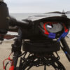
Drones are monitoring devices with the ability to capture spatial, spectral and temporal information applicable to a wide range of applications. Also referred to as Remotely Piloted Aircraft Systems (RPAS), the devices are versatile, adaptable and flexible. They can be rapidly and repeatedly deployed for high spatial and temporal resolution data. Equipped with data capture capabilities, they facilitate the collection of information in hard to reach or physically inaccessible areas. Drones suitable for use above and below water are available, ideal for the dredging and maritime industries.
Remote visual inspection
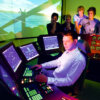
Drones enable remote visual inspection of environments, keeping workers away from hazardous areas such as confined spaces, extreme heights and places with energised equipment. By using drones, the workforce stays out of harm’s way while reducing downtime and inspection costs. From a remote location, pilots can bring a drone to the most inaccessible places up to multiple hundreds of metres beyond the line of sight.


