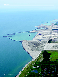
A fixed and direct transport connection between Scandinavia and Central Europe has been an enduring vision for many decades. This vision is about to be realised with the construction of the Fehmarnbelt Fixed Link, an 18-kilometre-long immersed tunnel between Rødbyhavn in Denmark and Puttgarden in Germany. When it opens in 2029, the tunnel will be the longest immersed tunnel in the world combining a dual railway and motorway connection. This article provides insight into the improved dredging equipment used and the methodology specially adapted and further developed to the project’s requirements.

Project background

The Fehmarnbelt Fixed Link has been designed and planned by Femern A/S, a subsidiary of the Danish, state-owned company Sund & Bælt Holding A/S. In 2008, a state treaty was approved and signed by the Danish and German governments. Both countries agreed that Denmark would be solely responsible for financing the coast-tocoast project (and the related extension of the Danish coastlines) and therefore be the sole owner of the Fixed Link. In turn, Germany will finance and ensure the timely development of the land works on the German side. The treaty stipulates that the link will consist of a twin-track railway and a four-lane motorway.

The toll station for the users of the Fixed Link will be located on the Danish side of the Fehmarnbelt. Femern A/S was responsible for designing and providing the basis for the official approval of the coast-to-coast section of the Fehmarnbelt Fixed Link on behalf of the Danish Ministry of Transport. After a series of investigations between alternative solutions (an immersed tunnel, a bored tunnel, a cable stayed bridge and a suspension bridge), Femern A/S recommended an immersed tunnel as the preferred technical solution for the Fixed Link.

The Fixed Link will fill the infrastructural gap between Scandinavia and mainland Europe by means of an efficient and high-quality transport infrastructure. In addition, the railway connection will result in the highly needed release of the Danish East-West rail connection. Freight trains from Zealand, Sweden and Norway will be able to take the direct tunnel into Germany and mainland Europe instead of the current longer route via Southern Jutland and Northern Germany (Hamburg), shortening the rail freight distance by 160 kilometres. Thus, the Fehmarnbelt Fixed Link is part of the Trans-European Transport Network (TEN-T) (Figure 1). TEN-T’s policy addresses the implementation and development of a Europe-wide network of railway lines, roads, inland waterways, maritime shipping routes, ports, airports and railroad terminals. Its ultimate objective is to enhance the efficiency of the European infrastructure so that the EU’s single market functions better and with less environmental impact. The tunnel will also offer a new strong link to the Fehmarnbelt region itself, stimulating growth and prosperity. Nine million people currently live in the region, which extends between the cities of Hamburg, Kiel, Lübeck, Copenhagen and Malmö. The project will not only provide work for local people but will also create jobs at companies in the region supplying the site with raw materials, goods and services.

After an international competitive bidding process, the Tunnel Dredging and Reclamation (TDR) contract was awarded to Fehmarn Belt Contractors (FBC), a joint venture between Boskalis and Van Oord. FBC started preparations in 2019 and actual operations commenced in June 2020 when the first rock was placed to start construction of the breakwaters around the Lolland work harbour in Denmark.

Figure 1

Trans-European Transport Network (TEN-T).

Geology

Figure 2 shows the geological longitudinal profile along the tunnel alignment. Both the Danish and German sides have gently sloping near-shore profiles, with a maximum water depth of around 30 metres. In order to accommodate the immersed tunnel the maximum dredging depth will be approximately 46 metres.

Figure 2

Geological profile along tunnel alignment.

The soils to be dredged for the tunnel trench comprise of upper layers of post glacial and late glacial deposits (gyttja, sand, silts and clays). Underlying layers are made up of glacial deposits (clay and sand tills followed by a Paleogene layer with highly plastic to extremely plastic clay). The German side is characterised by Paleogene clays together with some clay-till and the central basin (the central part of the geological cross section along the tunnel alignment) by gyttja, sands, silt and clays. Thick deposits of hard clay-till dominate the Danish side. In total, eight separate units are distinguished in the geological longitudinal profile of the tunnel trench:

Unit 1: Postglacial sand
Unit 2: Postglacial gyttja and freshwater peat
Unit 3: Postglacial/late glacial clay and silt
Unit 4: Postglacial/late glacial sand
Unit 5: Upper till
Unit 6: Meltwater deposits
Unit 7: Lower till
Unit 8: Palaeogene clay

Each unit features different characteristics when it comes to ease of dredging, placement in land reclamation or foundation of tunnel elements.

Unexploded ordnance and naval archaeology

The survey and removal of any potential unexploded ordnances (UXOs) within the respective work areas comprised a series of activities that began in 2011. First, an initial desk study was carried out, followed by detailed surveys and a removal operation.

The desk study included searching for information in the Royal British Navy, German Navy and Royal Danish Navy archives. As a result, it became a precondition that no capital dredging works would be initiated until a full survey and removal campaign had been completed. Overall, the entire UXO clearance works comprised three individual phases: surveys, identification and removal or relocation of identified UXOs.

UXO and other surveys

Surveys were carried out by the specialist company Heinrich Hirdes (a Boskalis subsidiary) deploying its state-of-the-art equipped fleet for the purpose. A towed magnetometer array measuring the total field amplitude was deployed within the respective work areas with a line spacing of 1.5 metres between each magnetometer array, in combination with a multibeam and side scan sonar survey. To meet the specified detection criteria, a maximum towing height of the magnetometer of 4 metres above the seabed was used as the threshold.

Based on the magnetometer survey, the target list was correlated to the anomalies detected by the combined multibeam and side scan sonar survey to identify the surficial targets. The survey campaign resulted in a final target list comprising 2,663 potential targets, approximately half of which were classified as potential UXOs.

The entire UXO clearance works comprised three individual phases: surveys, identification and removal or relocation.

UXO identification and removal campaign

Subsequent target inspections were performed by deploying a specialised tool operated from a work pontoon within the nearshore area and from survey vessel Kamara covering the offshore areas (Figure 3). The specialised tool combines a group of instruments and equipment for the purpose, including an acoustic profiler system, the EM detection system, an imaging sonar, a dredge pump and finally an orange peel grab for the recovery of an item. The configuration allows for immediate switching between all these individual tools (Figure 4).

Figure 3

UXO survey and identification vessel Kamara.

Figure 4

UXO survey multitool.

Relocation of identified UXOs

Further handling of identified UXOs depended on the conditions of each object as concluded by the previous investigations. Therefore, the encountered ammunition objects were classified as follows:

  • Any UXO concluded as safe to transport was recovered onto the deck on the inspection vessel and subsequently handed over to the responsible authority in the Port of Kiel, Germany;
  • Any UXO not safe to transport on deck was relocated by means of underwater transport facilities to another wet storage location – again in collaboration with the German authorities; or
  • In the case of an UXO being neither safely transported nor relocated to another area, the UXO was blasted in situ by respecting the requirements from the respective German and/or Danish authorities.

Within the Danish territory, the Royal Danish Navy monitored and assisted the campaign with the actual identification of UXO items, and took charge in the event of a removal operation, i.e. explosive ordnance disposal (EOD). In the German territory, Heinrich Hirdes operated on its own until the need for German authorities to remove identified items. A special and an extraordinary set up of requirements of mitigation measures for the removal of any UXO in the areas close and inside the Natura 2000 (a network of core breeding and resting sites for rare and threatened species) were put in place. This is a result of extensive talks with German authorities on enhanced and underwater noise mitigations from the EOD of an UXO, such as double bubble curtains and pingers.

Based on the UXO survey campaign 119 UXO targets were investigated. Of the 119, 104 were cleared as non-UXO targets, one as an old anchor and 12 UXO targets were relocated to a wet storage area in German waters. One UXO target was cleared by the German Navy and one UXO target located in Danish waters was cleared by specialists of Heinrich Hirdes in 2022 by controlled detonation.

Naval archaeology

Detailed surveys performed in preparation of the dredging activities also included locations of known historical wrecks; Swarte Arent and Lindormen (found in 2012 during preparatory surveys) and the Danish historical vessel Delmenhorst near the coast of Lolland (found during the detailed UXO surveys). All three vessels were lost in 1644 during the Battle of Fehmarn. Both Swarte Arent and Lindormen are located at larger water depths near the tunnel alignment. Based on the detailed surveys, specific exclusion zones were established to preserve the historical wreckage. Delmenhorst was discovered at a nearshore location within the perimeters of the land reclamation west of Rødbyhavn (Figure 5). In close concert with the Vikingship Museum of Roskilde, it was decided to cover the Delmenhorst wreck with gravel and rock prior to construction of the land reclamation to preserve the wreck and to facilitate possible future excavation within the land reclamation.

Figure 5

Delmenhorst historical wreck. Photo © The Viking Ship Museum, Denmark. Photo/illustration: Morten Johansen.

Offshore construction scheme

Laying close to the existing infrastructure, the alignment for the 18-kilometre-long immersed tunnel passes just east of the existing ferry ports in Puttgarden and Rødbyhavn (Figure 6). The tunnel will be constructed from 89 prefabricated tunnel elements. Each one will be cast in a temporary factory just east of the portal area on Lolland and then towed to the alignment for immersion into the excavated trench below the seabed. The offshore construction activities are planned with a duration of almost 5 years and involve a series of various marine works:

  • Constructing containment dykes around reclamation areas;
  • Construction of a work harbour for production and towing out of the tunnel elements;
  • Dredging of the tunnel trench;
  • Placing of a permeable gravel bed for the foundation of the tunnel elements;
  • Towing out and immersion of the tunnel elements;
  • Backfilling with locking fill;
  • General backfilling; and
  • Placing of a protection armour layer.

As seen in Figure 7, the protection layer on top of the tunnel will be lower than or in level with the surrounding existing seabed. This means that after completion of the tunnel construction the water depth will be as it is today. This article will describe the first three of the above listed activities.

Early works

Before the real coast-to-coast tunnel trenching can commence some major preparatory construction works must be prepared and in place. These early works comprise construction of structures close to shore on both the Danish and German sides, which will support the subsequent construction phases (dredging and reclamation phase and immersion phase). The early works comprise two work harbours, one on the German side at Fehmarn and one on the Danish side on Lolland. The work harbours are used to provide a safe haven for marine construction equipment, to facilitate the transport of personnel and to provide facilities for supply, stockpiling and load-out of materials and equipment. Furthermore, the tunnel elements are produced and towed out from the work harbour on Lolland. Both work harbours are integrated into the planned reclamation areas.

On the Danish side, the early works started one year before the tunnel trench dredging phase. This is to ensure that the necessary sections of the containment dykes surrounding the reclamation areas are ready to receive the dredged material from the tunnel trench. These early works will continue during the dredging phase and finish in time to ensure that the work harbour is ready for the production of tunnel elements used in the immersion phase. The work harbour on the Danish side also includes dredging of an access channel to a depth of -10.3 metres. On the German side, the early works started around four months into the dredging phase to ensure that the work harbour is in operation during most of the dredging phase and the entire immersion phase.

Element casting factory and work harbours

For the production of the 89 tunnel elements, a purpose-built factory has been constructed in the work harbour on Lolland. This harbour will also be the main harbour for servicing and berthing of the construction vessels used by the contractors working for Femern A/S. A smaller work harbour will also be constructed on Fehmarn island, East of Puttgarden ferry harbour.

Reclamation areas – preparations

All the dredged material from the excavation of the tunnel trench as well as the work harbours will be placed into reclamation areas at Lolland and Fehmarn. On both sides of the Fehmarnbelt, reclaimed land will be constructed in the form of artificial land reclamations that will extend approximately 500 metres into the sea. Containment dykes will surround the future reclamation areas using stones supplied by rock carriers.

The new peninsula at the northern coast of Fehmarn serves as abutment for the tunnel portal structures and contributes to making the intervention in the existing coastline as gentle as possible. On the Lolland side there will be two reclamation areas, located on either side of the existing ferry harbour at Rødbyhavn. It is planned that the reclaimed land will not extend beyond the breakwaters of the ferry harbour.

Figure 6

Tunnel alignment between Lolland and Fehmarn.

Figure 7

Tunnel element backfill and protection layer.

Dredging and reclamation works

An approximately 18-kilometre-long trench must be dredged into the seabed of the Fehmarnbelt between Lolland and Fehmarn, representing the majority of the dredging work in terms of the quantity of dredged material and the associated construction time. Excavated into the existing seabed, the trench will measure up to 90 metres wide and 16 metres deep. It is estimated that the volume of material to be dredged in situ to create the trench is around 14,500,000 m3 and dredging of the trench is planned to run over a period of 18 months.

Dredging processes

The dredging process comprises dredging of material from the tunnel trench, transportation of the dredged material to the reclamation areas and unloading of the excavated material into the reclamation areas. The applied dredging methodology is a combination of mechanical dredging with backhoe dredgers (BHD) and grab dredgers (GD) and hydraulic dredging and placement deploying trailing suction hopper dredgers (TSHD). Backhoe dredgers will dredge the shallower parts of the tunnel trench at both the German and Danish sides of the Fehmarnbelt to a depth of approximately -25 metres. Deeper parts below this depth will be dredged by a combination of grab dredgers and trailing suction hopper dredgers.

TSHD’s will make use of a special draghead for handling of the very hard clay-till, combined with a recirculation system that pumps water from the hopper back to the seabed in order to minimise spill of fine sediments into the environment and to optimise the dredging process. The mechanically dredged material is loaded into transport barges that then sail to the nearshore reclamation areas where the soil is unloaded. Both towed barges and self-propelled (split hopper barges) are deployed for the project.

Boulder removal

Boulder removal from the dredged till is an essential part of the dredging works and the progress thereof. A TSHD can remove and transport boulders up to a maximum diameter of approximately 0.3 metres as part of the normal dredging and offloading process. This limiting dimension is based on the dimension for dredge pump passage. A grid is installed in the draghead to prevent larger boulders from entering the pump. Larger boulders will remain on the sea bottom but will be exposed by the TSHD to enable other vessels to remove them.

It is anticipated that one boulder (larger than 0.3 metres in diameter) per 50 m³ will be encountered on average, which will result in a large number of boulders needing to be removed simultaneously with the TSHD operation. The quantity of boulders left on the seabed will in turn have an effect on the production rate of the TSHD. One unknown is the distribution of boulders, which may be encountered evenly spread over the tunnel trench or found clustered in large quantities (nests).

A large number of the boulders left on the seabed will be removed by a fishing net operation, deploying a medium or large size multicat. After positioning, the net is lowered from the stern of the vessel. During the subsequent towing, the resistance on the net increases gradually. This resistance is continuously monitored on board until time for recovery (Figure 8).

Figure 8

Recovery of the boulder removal net.

Sediment spill management

In view of previous experiences with largescale marine infrastructure development projects in Denmark, the proper control and management of fine sediments originating from the dredging and reclamation activities are a crucial aspect of all preparations and execution of the project. Following extensive environmental research, a total sediment spill budget was defined before works began. This sediment spill budget is split into smaller parts, distributed by time (months and seasons) and space (eight spill monitoring areas along the alignment of the tunnel trench, including near shore areas at Lolland and Fehmarn). Spill budgets range from negligible or zero in certain environmentally sensitive areas in the summer to several tens of thousand tonnes in less sensitive areas over the winter period. Overall compliance is monitored at all these levels and totals. Contractor FBC has the responsibility to ensure compliance using extensive field monitoring and numerical modelling (Figure 9), including verification of achieved accuracies at the end of all dredging operations.

In practice, FBC modelled potential sediment spill originating from different soil units and different dredging and reclamation methods in detail. By verifying applied parameters for this modelling through extensive field monitoring of dredge plumes and sediment concentrations at the permanent works boundaries, the modelling is validated (Figure 10). Results of this modelling and monitoring are published online.

Figure 10

Spill monitoring results.

Reclamation works

Reclamation works are executed on both the German and Danish sides of the Fehmarnbelt. The largest share of the dredged material will be placed at the Danish side in newly constructed land reclamations. A smaller part of the dredged material will be placed at the German side or in specific stockpiles onshore.

The reclamation areas on both sides consist of bunds constructed of mechanically dredged upper till, quarry run, filter layers and armour layers. The reclamation basins are specifically designed for the purpose of receiving the dredged material from the tunnel trench, which is placed both mechanically by direct offloading from barges or dump trucks and hydraulically by pumping ashore material from hopper dredgers. All reclamation areas are initially accessible for direct placement from transport barges by leaving parts of the reclamation bunds open for marine access.

Some reclamation areas are subsequently closed off in preparation of hydraulic placement of material, for which raised bunds are constructed to manage process water and contained fine sediments. Other reclamation areas are also closed, when transport barges no longer have access due to reduced water depths as a consequence of material placement. Those areas are subsequently filled to final design levels using dump trucks that are loaded at several temporal or more permanent offloading quays receiving the transport barges.

Specific placement methods, planning and locations depend on several criteria, which are all considered in detail during the design and work preparation stage. Each geological unit dredged in the trench features specific strength and other characteristics, making it more or less suitable for placement at certain locations (see Figure 2):

  • Unit 1 (sand found at sea bed level) becomes available in the early stages of the tunnel trench dredging and can be used for (intermediate) bund construction or drainage layers between other units;
  • Unit 2 (gyttja, commonly found at higher levels in the tunnel trench) has relatively low strength after dredging and needs to be covered at all times to avoid the material oxidizing. It is therefore placed as fill material in the lower parts of the reclamation areas;
  • Unit 5 (upper till, found at all levels in the tunnel trench) has significant strength when dredged mechanically and transported carefully, and can be used for bund construction or construction of the erosion cliff featured at the Eastern extreme of the reclamation areas at Lolland; and
  • Unit 3 and unit 8 (silty clays and Paleogene clays) are dredged mechanically primarily and mainly placed as fill material in view of anticipated lower strength after dredging.

Hydraulically dredged material (unit 5 upper till, unit 4 silty sands and unit 7 lower tills) are found at lower levels in the tunnel trench and therefore dredged in later stages of the trench excavation process. These are placed at higher levels in the reclamation areas, as fill or surface covering material only.

Please note these are generic guidelines only, based on actual monitored material characteristics other placement locations or purposes will be selected. In general, there is a shortage of dredged material of sufficient strength to construct bunds and stockpiles on shore. Therefore, careful monitoring of actual behaviour of dredged material, management of transport processes towards all available placement locations and selection of most suitable material is a key success factor in the entire land reclamation process.

Selection of dredging equipment

The dredging of the tunnel trench requires a small fleet of dredging equipment. Both the geometry of the tunnel trench (depth of the seabed, excavation depth of the trench including deeper special elements) and the geology of the materials to be excavated require specific dredgers to be deployed. Additional requirements related to beneficial use of dredged material in the reclamation areas also need to be taken into consideration when selecting the appropriate dredging equipment.

Firstly, the tunnel trench excavation scope is divided into mechanical dredged parts and hydraulically dredged parts. Hydraulic dredging by TSHD’s generally features higher production rates and is therefore considered more cost efficient, although not all geological units can be dredged or pumped ashore efficiently by TSHD’s. However, TSHD require minimum floatation depths and hydraulically dredged and transported material might feature lower strengths after placement when containing large percentages of fines.

Secondly, the mechanically dredged material is partly in reach of backhoe dredgers (depending on the strength of in-situ material up to 25 metres of water depth). Mechanical excavation at greater water depths will be done deploying grab dredgers.

Thirdly, the final choice of dredging equipment also depends on total spill of fine sediments into the environment. During dredging operations, inevitably some percentage of fine sediments is released into the environment, the exact amount of which is largely depending on methods deployed. For each method, a source term of potential spill is determined and the final choice of equipment and methods is calculated for minimisation of total spill.

Taking these considerations into account, three main types of dredgers were chosen for the tunnel trench excavation works:

  • The world’s largest backhoe dredgers were selected for the shallower parts of the dredging scope at both the German and Danish sides of the Fehmarnbelt, up to water depths of 25 metres in view of efficient dredging of the high strength upper tills (Figure 11);
  • Newly built grab dredgers were chosen for mechanical dredging of the deeper parts of the tunnel trench, including the relatively small special elements (Figure 12). Selection of wire cranes is based on optimised hourly productions in specific material to be excavated; and
  • Large trailing suction hopper dredgers were selected for the hydraulic parts of the dredging scope (Figure 13).
Figure 11

Backhoe dredger Magnor and transport barge.

Figure 12

Grab dredger Manta.

Figure 13

Trailing Suction Hopper Dredger, Vox Amalia.

Technical developments and innovation

In spite of the large fleet of existing dredgers available for the project, several technical developments took place before actual deployment for tunnel trench excavation. These include the development of a recirculation system for process water used for hydraulic dredging by TSHD’s, a system for boulder catching on board of the TSHD’s, the development of purpose-built grab dredgers and the development of draining excavation buckets for backhoe dredgers.

The recirculation system for process water reduces the amount of water spilled into the environment during dredging and loading of the water. By recirculating water from the hopper of the dredger towards the draghead, the time before start of overflow is lengthened and the amount of water spilled through the overflow of the hopper is reduced. In view of requirements imposed on dredging operations (mainly related to minimisation of release of fine sediments into the environment), this optimises the loads taken ashore in each dredging cycle.

The grab dredgers deployed for tunnel trench dredging are purpose-built for the project.

The system for boulder catching on board of the TSHD used for dredging of upper till is required to avoid build-up of residual loads in the hopper consisting of boulders that are dredged but not pumped ashore. As previously explained, all boulders encountered smaller than 0.3 metres in diameter are dredged and pumped into the hopper. However, boulders larger than 0.2 metres are unlikely to be pumped ashore while unloading, leading to build-up of residual loads over time. To avoid this, a system of boulder catching on deck of the TSHD has been developed, in which boulders sized between 0.2 and 0.3 metres are selected, removed and transported to shore for beneficial use.

The grab dredgers deployed for tunnel trench dredging are purpose-built for the project. Using existing sea going multi-purpose pontoons and newly built wire cranes, optimised production rates for the specific conditions of the Fehmarnbelt project (i.e. offshore workability, optimised dredging cycle times and optimised bucket loads) could be achieved. Specific developments included the design and construction of purpose-built grabs for specific geological units and a system for recovery of energy while lowering the bucket in order to minimise fuel consumption and related CO2 release.

To preserve as much as possible the strength of upper till during dredging and transport (required in view of beneficial use of upper till for bund construction), several draining dredging buckets were developed for the different backhoe dredgers deployed. Strength of upper till depends to a large extend on the moisture content. Reduction of moisture content or avoidance of increase of moisture content of the upper till is therefore of utmost importance. To achieve this, several skeleton buckets and general purpose draining buckets where designed and constructed.

Conclusions

After half a year of work on the excavation of the tunnel trench, experience has shown the dredging and reclamation process is as challenging as ever anticipated. Governed by strict environmental requirements, cumbersome COVID-19 challenges and the local climate conditions, the works can be seen as progressing according to schedule.

At the same time, the tunnel trench deposits to be excavated sometimes deviate from original estimates, which were based on extensive soil investigation campaigns, laboratory research efforts and geological modelling. This resulted in a detailed soil model describing predicted distribution of soil units and related characteristics as in-situ strength and remoulded strength (relevant for placement in the reclamation areas). These small but sometimes relevant deviations from predictions result in the need for highly adaptive management of dredging and reclamation activities, which are implemented in close consultation between Femern A/S and the contractor FBC.

The technical developments already deployed in the works, such as the draining buckets for the backhoe dredgers and the newly constructed grab dredgers, perform according to expectations. Other innovative systems, like recirculation of process water, will only be put to the test in the near future.

Authors

Claus Iversen

With an MSc in Hydraulic and Coastal Engineering from the Danish Technical University and more than 40 years’ experience, Claus Iversen has worked as a superintendent or contract director for various large-scale marine related infrastructure projects in Denmark and abroad. Major assignments have included dredging and reclamation projects for the Great Belt Link, followed by the tunnel trench dredging and reclamation for the Øresund Fixed Link. From 2005-2008, Claus was responsible for the supervision of the construction of the deepest immersed tunnel in the world under the Bosphorus in Istanbul, Turkey. From 2008-2021, working for Femern A/S as construction manager (marine works), he was involved in the preparation and permit application for the construction of the Fehmarnbelt Fixed Link project. In between, Claus has worked as an expert consultant to UNDP in Vietnam, to FAO in South Korea and to the Danish International Development Agency (DANIDA) in Sri Lanka and Egypt.

OTHER ARTICLES BY THIS AUTHOR
Arjan van der Weck

After graduating with an MSc in Physical Geography and Coastal Morphology from Utrecht University in the Netherlands, Arjan worked for the Dutch Ministry of Public Works and Water Management and later Delft Hydraulics (now Deltares). He joined Boskalis in 2008 and oversaw the engineering department Hydronamic for 10 years. He was then tender manager and engineering manager for the Pulau Tekong polder construction project in Singapore. Arjan is currently design and engineering manager within Boskalis and a member of the project management team of Fehmarn Belt Contractors (FBC), responsible for design, engineering, equipment development and sediment spill management.

OTHER ARTICLES BY THIS AUTHOR
Pieter van der Klis

Having gained an MSc in Civil Engineering from Delft University of Technology in the Netherlands, Pieter started his career at Ballast Nedam as a coastal engineer. He continued to work for the dredging division and was involved in the Storebaelt Bridge and Oresund Link projects. Since 2004, Pieter has worked for Van Oord. During this time, he was responsible for the design of the northern breakwater of the Maasvlakte II project in Rotterdam and later manager of the engineering department in Dubai serving many projects in the region. He was also stationed as engineering manager in Kuwait for the KNPC project. From 2013-2022 Pieter was design and engineering manager for Fehmarn Belt Contractors (FBC) responsible for the dredging and reclamation contract. He currently works for the protection and rehabilitation of the Romanian coast contract and is chairman of the Environmental Committee of EuDa.

OTHER ARTICLES BY THIS AUTHOR